Lorine Estate

The development of organic agriculture and agritourism.
POTENTIAL
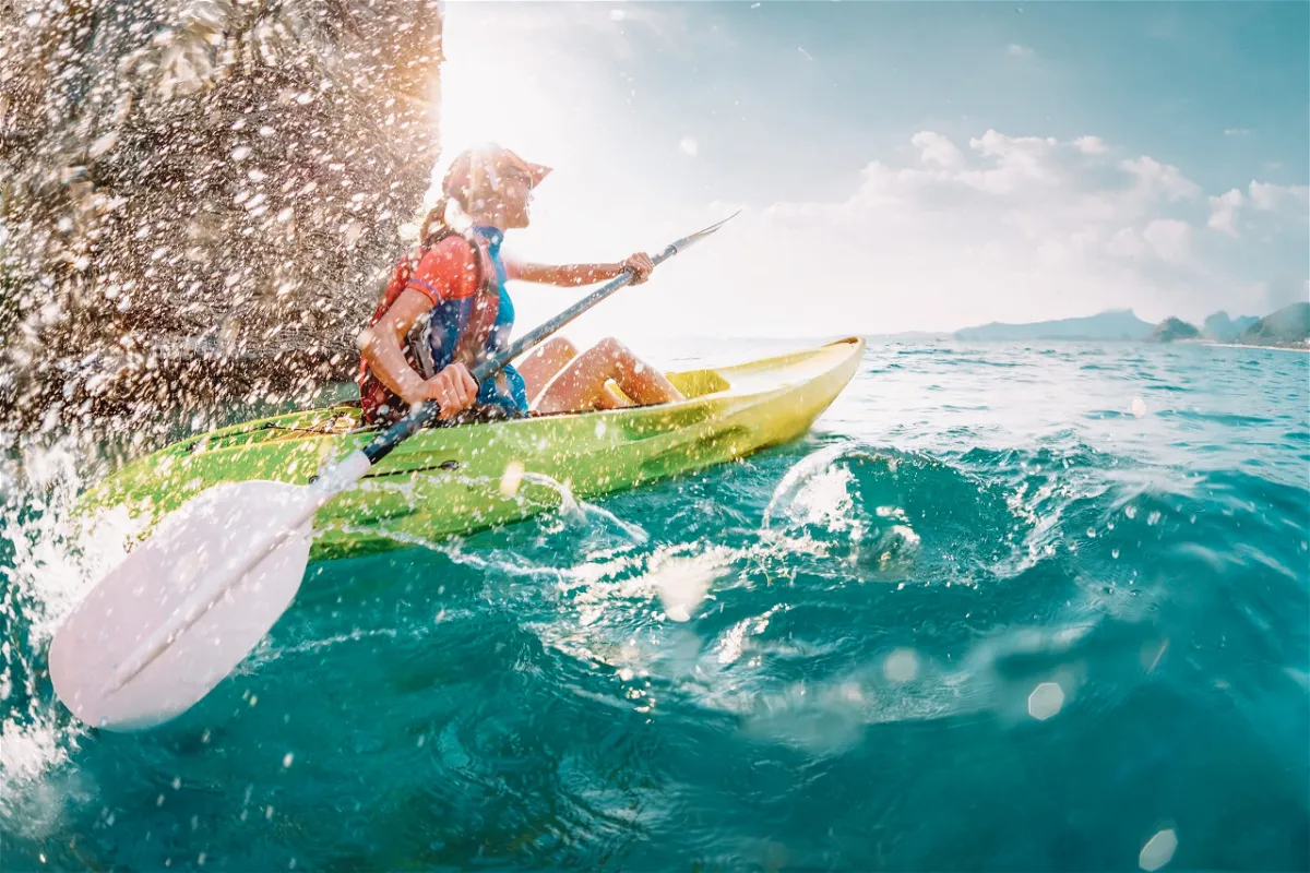
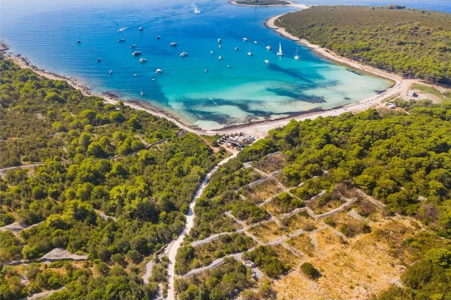
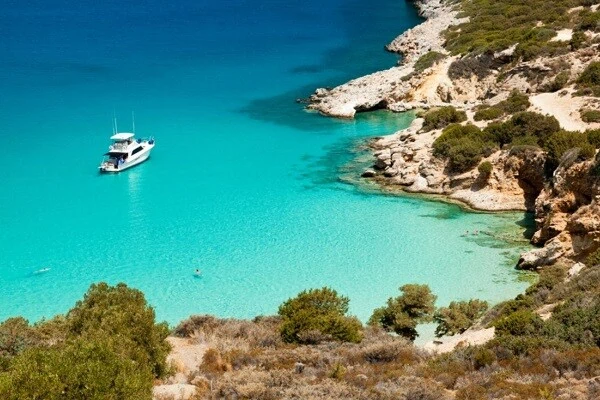
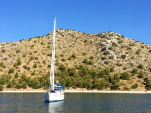
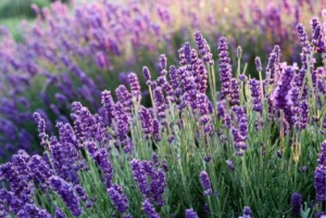
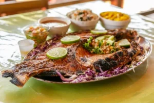
Organic agriculture and eco-agro tourism represent the natural potential of Croatia, and the nature parks and preserved landscapes are particularly suitable for that. Lorini property, located in the Nature Park Telašćica, offers much more than spectacular views of the Kornati islands and beautiful intact nature. The property is ideal particularly for the development of these types of activities. Picture yourself walking down an olive grove, trying a freshly picked fig or a liqueur made of a rare species of sage, and breathing in the scents of medicinal herbs and sea. Imagine yourself developing your own business – agritourism, recreational tourism, health and educational tourism, nautical tourism, ecotourism, etc.
This gift of nature has been recognized in Croatia, therefore, the development strategy focuses especially on the trend of organic agriculture and eco-agro tourism. The availability of EU funds for the development of these activities, the existence of legislation and state incentives have led to significant growth in this area. This trend is also strengthening due to the changes in demands on the market and the emergence of increasingly complex motives for taking trips, which include intense relaxation, outdoor activities, need for adventure, visiting environmentally clean areas and taking care of personal health, nutrition, and living in harmony with nature.
INTACT NATURE IN THE HEART OF EUROPE
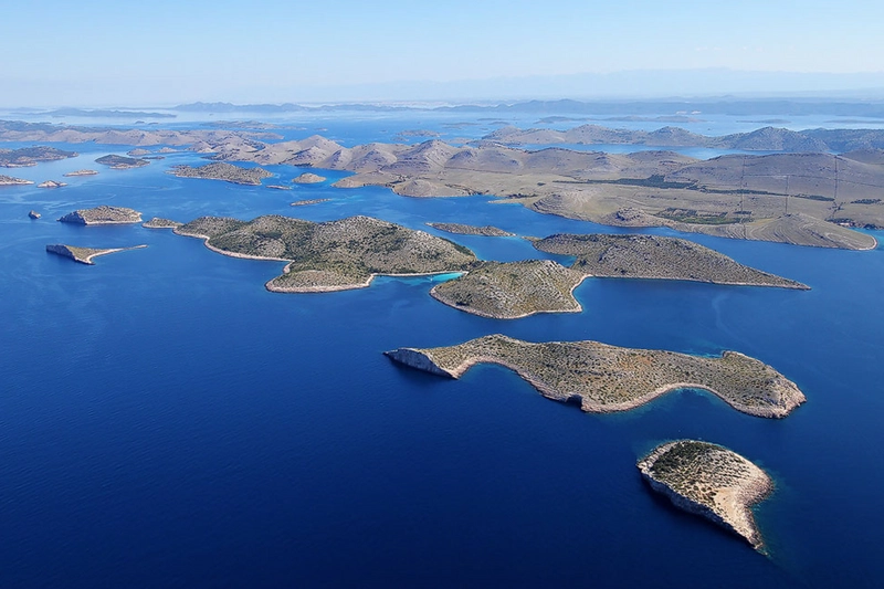
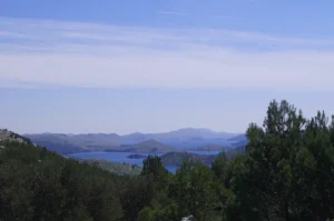
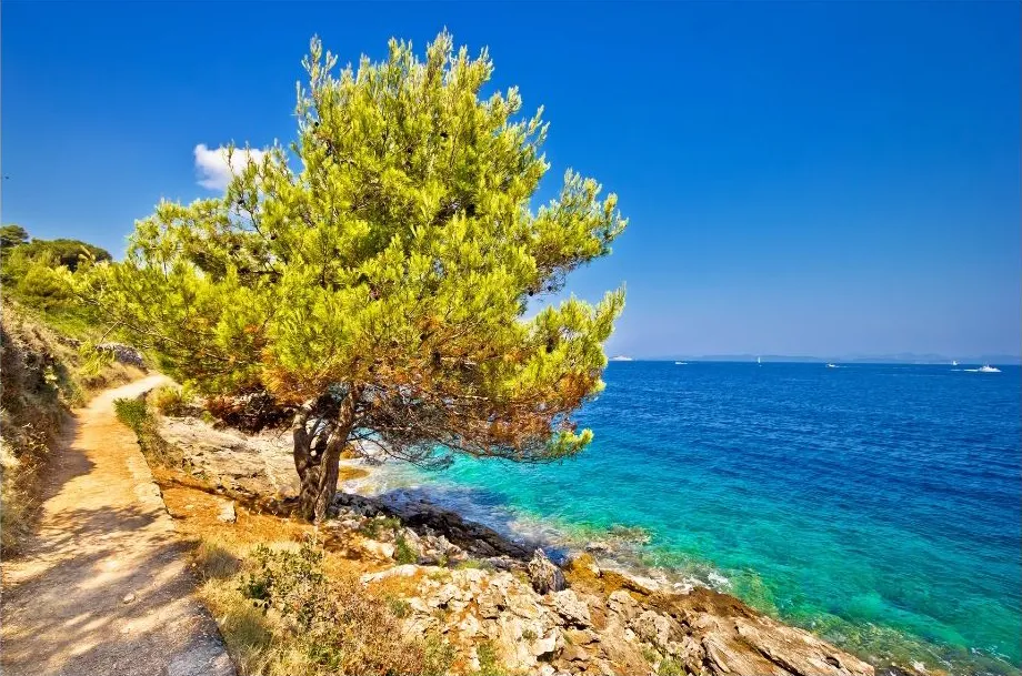
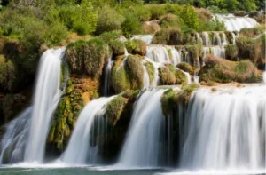
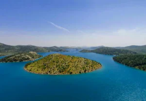
The Kornati islands are one of the most beautiful Mediterranean archipelagos According to legend, they were made from white stones that were still left in God’s hand while creating the world, so he threw them over his shoulder.
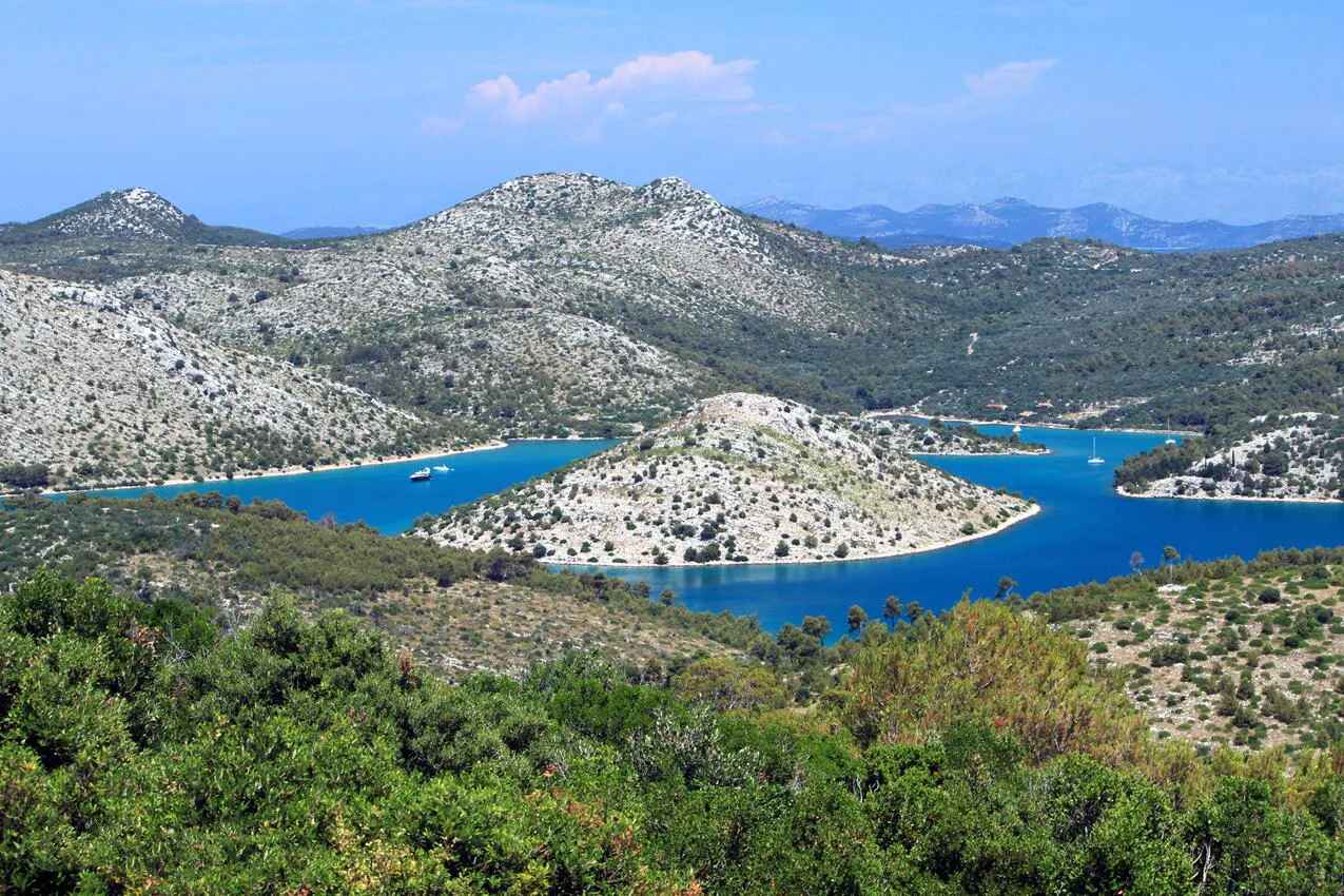
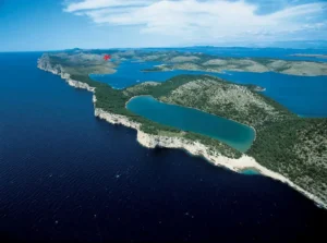
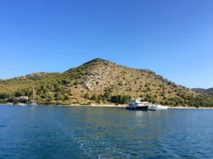
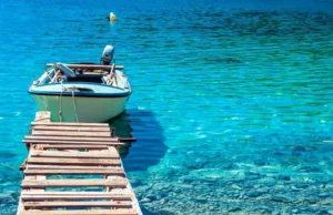
Unique blue sea, unusual relief structures and forms of over 140 uninhabited islands, steep cliffs, plenty of sunshine, picturesque bays and ports make Kornati favourite nautical destination. Dugi otok is situated at the gates of Kornati National Park. A part of this labyrinth of land and sea was declared a Nature Park Telašćica. The Telašćica bay is one of the safest, most beautiful and largest natural ports in the Adriatic.
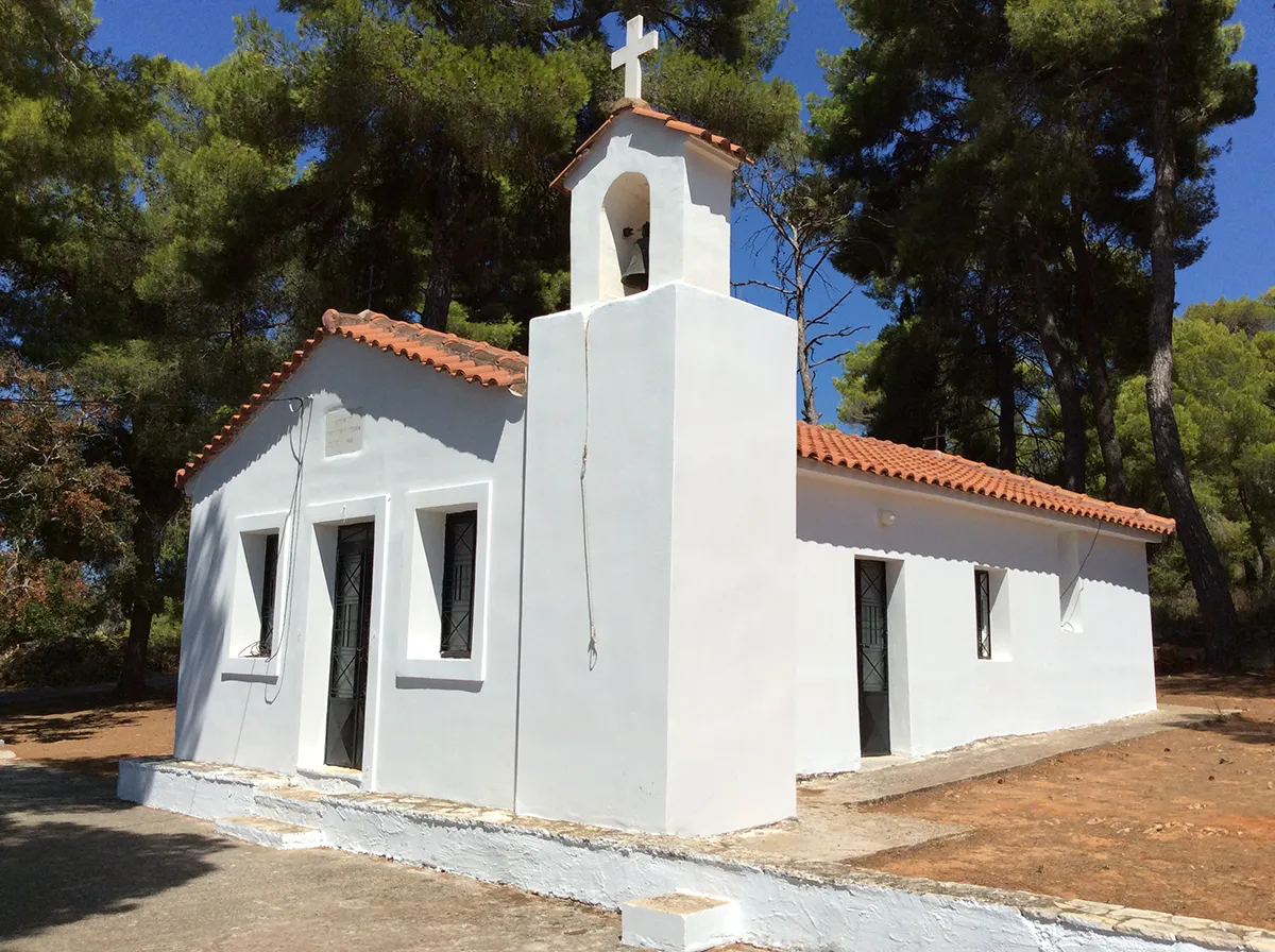
Owing to its position, it is protected from strong gusts of bora wind from the mainland and from sirocco blowing from the open sea. There are 6 islands and cliffs inside the bay and 25 small coves on the 69 km of indented coastline. The name “Telašćica” probably comes from the Latin name of “tre lagus” which means “three lakes”. There are numerous traces of the island’s long history evidenced by the prehistoric remains, and the remains of various civilizations like the Illyrian, Greek, Roman and Byzantine, as well as numerous Christian and pre-Romanesque churches.
The area of Nature Park Telašćica is rich in contrasts with quiet and peaceful beaches and wild and rough cliffs; the area of the Aleppo pine and holm oak woods on the one side and bare rocky grounds on the other; the area of cultivated fields of vineyards and olive groves, but also
the area of scant forms of vegetation.

CONSTRUCTION AND SPATIAL PLANNING CONDITIONS
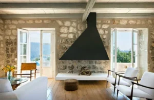
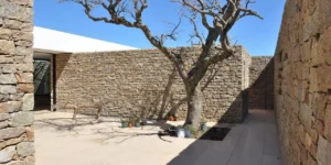
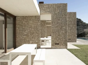
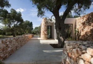
The space that directly belongs to the buildings must retain the existing characteristics of the area – the existing local plants, traditional stone walls, and the existing forest stands.
Each building must be laid on the ground configuration and designed to overcome the altitude differences by its volume. Their design must fit into the landscape. The length to height ratio of the facade must be in favour of the façade’s length.
Construction is permitted:
- for the purposes of a family run farm and provision of hospitality and tourism services, covering the area of 3ha and minimum 100 meters away from the coastline: ground floor up to 50m2 and max height up to 4m and/or completely buried basement area up to 200m2.
- for own economic purposes of traditional agriculture: more than 1000m from the coastline; minimum land area 1000m2; maximum height 3,5m; maximum number of floors Ground+Attic/Basement+Cellar, up to 30m2 in surface, construction in stone, gable roof, roof pitch up to 30 degrees; wooden structure, covering: roofing tile or natural stone slabs.
The construction of balconies, loggias and skylights is not permitted. The terrain around the building must retain its natural configuration and asphalting or concreting of access paths is not permitted. The construction of covered structures outside the body of the enclosed building is not permitted. A water tank up to 27m3. In order to prevent fire spread to adjacent buildings, the building must be at least 4 or more meters away from the neighbouring structures, or detached from the other building by a fire wall resistant to water for at least 90 minutes.
THE PROPOSAL OF SPATIAL FUNCTIONAL SOLUTION
NOTE: Below you may find a proposal of spatial solution that meets the legal requirements for obtaining the necessary permits for building and development. The interested investor is free to prepare his own proposal of spatial solution in cooperation with relevant institutions and to adapt building according to own needs.
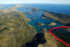
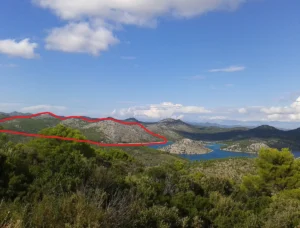
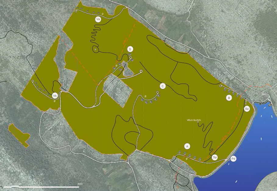
The area planned for revitalization/ recultivation is located in the extremely valuable protected area of the Nature Park Telašćica, spreading over the total area of 99 ha. In accordance with the relevant Spatial Plan and the applicable legislation governing protection of nature, this coastal nature park provides conditions for the Park management, protection and governance on the principles of sustainable development.
The concept of the Spatial Planning Study is based on the principles and conditions of the Plan (NN 22/2014), with respect to the essential natural and climatic characteristics of the area and its ethnological heritage (the prior-existing stone walls and the constructions currently existent in the contact area).
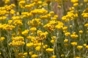
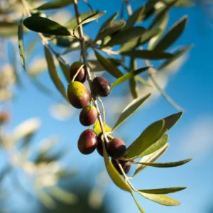
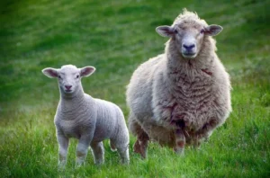
This area of steep terrain is climatologically characterized by mild winters and dry summers, known as the “climate of olives”. Due to this, and certainly considering the pedological characteristics and the terrain configuration, the zoning of the land on the basis of the existing cultures has been proposed, namely, the reconstruction of olive groves, breeding pasture areas with local plants, allowing pasture (in agreement with public entities), providing premises for beekeeping, and other activities that preserve and revitalize landscape.
Taking into account the legal provisions and conditions specified in the Plan, the area is roughly divided into four zones:
- The Littoral Zone – 100 and more meters from the coastline
- The Central Zone – divided into two sub-zones as follows: Zone A, which is adjacent to the Littoral Zone and Zone B, and Zone C and D
- The Peak Zone (the area in principle located more than 1000m from the coastline)
- the Zone of Maritime Domain – the area located immediately by the sea (which will be used in accordance with the relevant law and the special
conditions of nature protection)
Within the Littoral Zone, planned bin two sub-zones (the area of more than 3ha/approximately 3.1ha) is the area for storage, an open terrace,
and a parking lot, with the possibility of realizing a collective wastewater treatment plant (more than 100m from the coastline). The pedestrian/ bicycle pathways to the nearby site of Vela Glava are also associated with this area.
In the Central Zone A, which comprises the area of approximately 20ha, it is planned to build a group – complex of 5 (five) independent units (taking up the area of more than 3ha), the purposes of which range from the needs of a family run farm to providing hospitality and tourism
services in the framework of a rural household (pursuant to special regulations). The area taken up by each facility is 50m2 of the ground
floor area, and no more than 200m2 of the basement area. The area immediately surrounding the facilities is planned to be recultivated by planting olive trees, while the central area is to be left to pastures, i.e. cultivating authentic medicinal plants, beekeeping, etc. The access
to the building complex would be enabled by constructing the planned road from the coastal highway, which can additionally be connected to the
existing road on the south side.
In the Central Zone B, an identical concept consisting of a group – complex of five buildings taking up the area of approximately 20ha is planned. In the Central Zone C, an identical group – complex of buildings is planned, but these are situated in the foothills taking up the
area of approximately 20ha. The access to the complex would be enabled by constructing the planned road from the south side, which is to be connected to the existing road Due to foreseeable microclimatic conditions and the proximity of the existing olive groves, a significantly greater area is planned for olive groves within this Zone, while the remaining pasture areas are to be used for the same purposes as those within the other zones in order to preserve the integrity of the area.
In the Central Zone D (above the existing olive groves), an identical group – complex of buildings is envisioned, but these are situated in the foothills taking up the area of approximately 20ha. The access is provided on the west side via the existing road, which is planned to be partly upgraded for the purpose of preserving the areas planted with olive trees. Just like in Zone C, a significantly greater area is planned for olive groves in this Zone, while the remaining pasture areas are to be used for the same purposes as those within the other zones in order to
preserve the integrity of the area.
The zone above 1000 m – the Peak Zone is divided into two units, Pa and Pb. In accordance with the Spatial Plan and the relative law, the construction of one facility per unit taking up to 30m2 with the purpose of presenting the Park, and in agreement with the representatives responsible for the protected area, is enabled within these. Next to the facility, an additional surface is ensured for a 27m3 water tank. Pb can be reached from the west side via the existing road, and Pa from the east side via the existing road that needs to be upgraded within the zone. The purpose of this area is generally for pasture.
EMBARK ON AN EXPLORATION
Near the Lorini property, you can go diving on several attractive locations along the cliffs, walk along the paths and visit some interesting
places.
Nearby, there are also beautifully cultivated meadows and hillsides rich in Mediterranean vegetation with about 500 species of flora and equally
rich fauna. The undersea world has more than 300 plant and 300 animal species, including some rare species. These and numerous other beauties
attract the visitors to Nature Park Telašćica.
Some of the nearby attractions include:
- The cliffs of Dugi otok, or the socalled “Stene”, which rise up to 161 metres above the sea level and go 90 metres deep under the sea;
- Fort Grpašćak built on the highest part of the “stene” and served exclusively as the military lookout point of the Austro-Hungarian Navy;
- Salt Lake Mir, with its therapeutic properties;
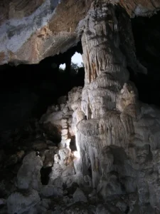
- Caves Strašna peć and Vlakno with very important prehistoric archaeological site;
- the Žman Lakes;
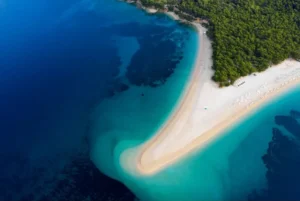
- Saharun beach;
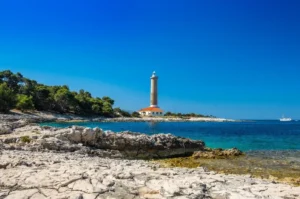
- Veli Rat lighthouse, the tallest lighthouse on the Croatian coast;
- Illyrian ruins, the oldest buildings on the archipelago, situated on the islands of Kornat and Žut;
- Villa Rustica, the remains of Roman buildings in Mala Proversa;
- St. Pelegrin in Savar, 9th century;
- Church of Our Lady of Tarac, the Queen of the Sea – the pilgrimage to Our Lady of Tarac and votive procession of boats is one of the most beautiful and interesting religious events in Croatia;
- The remains of the submerged salt pans;
- “Latinsko idro” (Latin Sail) on Murter – the most popular regatta of traditional boats on the Adriatic;
- Events: Saljske užanice (Donkey races of Sali) and Tovareća mužika (Donkey music);
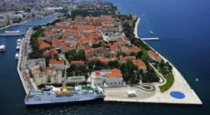
- Important cultural centres and beautiful towns Zadar and Biograd are also nearby;
- In the vicinity of Nature Park Telašćica, there are also four national parks:Kornati, Paklenica, Krka and Plitvice Lakes, as well as two nature parks – Vransko Lake and Velebit.
Why invest in Croatia
When opportunuty knocks – Open the door
“Croatia is one of the fastest-growing holiday destinations in Europe. In the last few years, Croatia has generated a lot of headlines in the tourism pages of the world’s media. It is easy to understand why. Its natural beauty, its historical and cultural legacy, its location within easy reach of major European population centres, and of course its climate, make Croatia an obvious growth market for tourism. Its accession to the EU in 2013 is one of the factors that Croatia is the new, up and coming destination.” – The Telegraph
It is situated in Central Europe and is one of the most beautiful countries of the Mediterranean, with more than 1.100 islands
- It is easily accessible, just a short flight away from major European centres through 7 international airports
- It has one of the lowest crime rates
- Clean and regulated environment
- 8 national parks and 11 nature parks
- Unique gastronomy and wine industry
- The conditions for yachting, sport and health tourism as well as for rural tourism
- High demand for unique and authentic properties, VIP holidays, private events, weddings and corporate events
- Attractive destination for ecotourism and organic agriculture owing to unique natural beauties and preservation of natural units
- Skilled workforce
Climate
- More than 2.500 hours of sunshine a year
- Average temperature in January is higher than 7°C and annual average is higher than 16°C
- In winter, the sea temperature is approximately 13°C and about 23°C in summer
Land, location, traffic connections
This land has the benefits of the Mediterranean region, favourable conditions for small livestock breeding, organic agricultural production (growing olives, figs, carob, medicinal herbs, viticulture, etc.), as well as the possibility of controlled hunting and ecotourism, for which there is a possibility of using the support of EU funding.
TRAFFIC CONNECTIONS AND INFRASTRUCTURE
Traffic connections
Access to the land: road, fire roads and paths (from one side, the seaward one, the plot is accessible by asphalt road, and from the other, in the middle, by fire path).
All the villages on the island are connected by an island road (good quality road) with a local bus line.
The construction of new routes and accesses to the plot needs to be resolved in accordance with local conditions, i.e. traditional agricultural, forest and fire paths, etc. It is necessary to preserve the landscape values by adjusting the routes to terrain configuration.
Boat Connection: boats, fast boats and ferry lines connect the island to the mainland several times a day. The number of lines is increased during the tourist season.
Heliport: on Grpašćak (Telašćica).
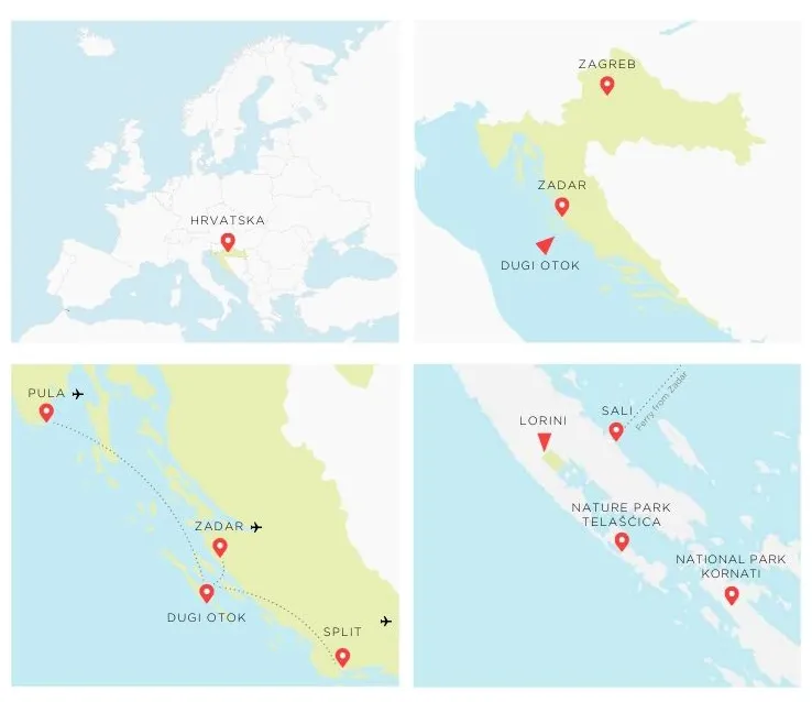
Nearest airport: Zadar.
Telecommunication system
The construction of distribution telecommunication system is envisaged. Until then, it is carried out via mobile phone networks.
Energy system
Power supply is carried out from the distribution network of the town of Sali. Cable laying is planned down the existing routes to the bay of Mir, with a branch to Grpašćak. Until then, solar energy and other renewable energy sources are available for own usage. The installation of solar collectors and/or photovoltaic cells on the rooftops and exceptionally on facades is permitted. The application of diesel generating sets placed in soundproof space is permitted.
Water supply
To be carried out by connecting to the public water supply system of the town of Sali. Until completion of the construction of a comprehensive
water supply system, water supply will be resolved by building own water tanks, and water will be transported by tank trucks from the water supply system in Sali. There are only a few pools in the park area, although occasional submarine springs indicate the presence of groundwater circulation. Near the park, there are two karst lakes (Small and Big Žman lake).
Drainage
To be resolved by a collective wastewater treatment plant within the littoral zone. Clean rainwater can be released in the ground or in the sea without treatment. Waste disposal facility is located in Veli Dočić.
For additional information and materials, please contact
LORINI ESTATE
email: [email protected]
tel: +33 6 50 51 42 35